Overview
Product Overview
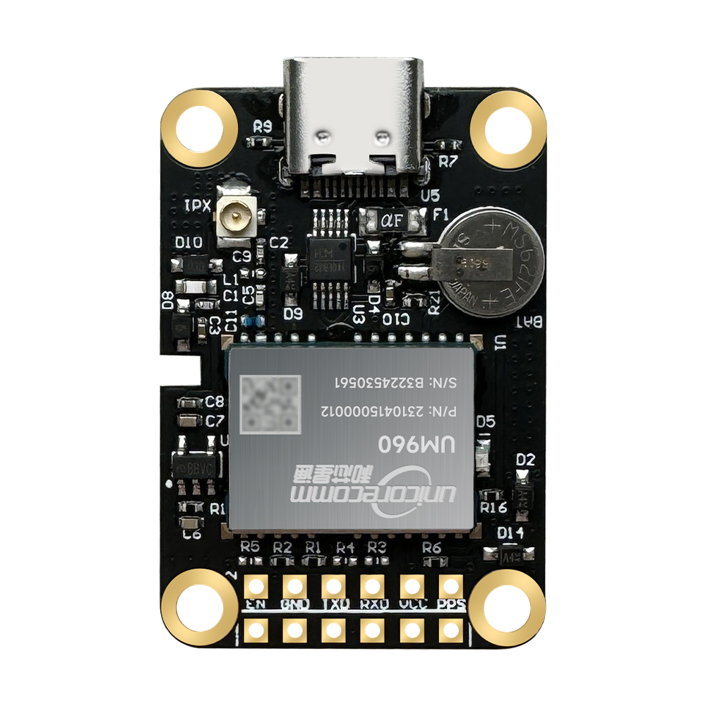
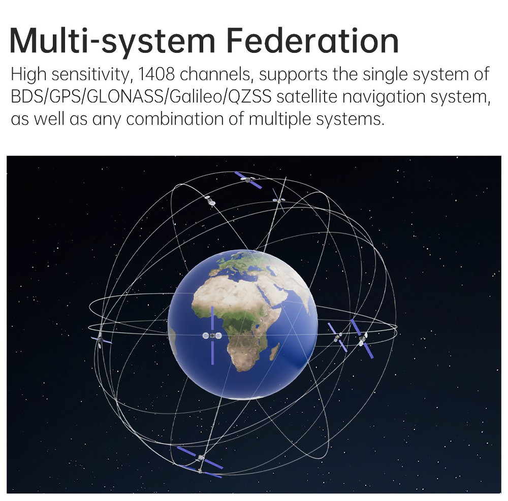
1.WTRTK-960 is a new generation of BDS/GPS/GLONASS/Galileo/QZSS full-system multi-frequency high-precision RTK positioning module, based on the new generation of RF baseband and high-precision algorithm integrated GNSS SoC chip—NebulasIV designed by Unicore Starlink.
2.It can simultaneously track BDS B1I/B2I/B3I/BIC/B2a*, GPS L1C/A /L2P/L5, GLONASS L1/L2, Galileo E1/E5b/E5a, QZSS L1/L2/L5 and other signal frequencies.
3.It is used in high-precision navigation and positioning fields such as deformation monitoring, high-precision GIS, drones, lawn mowers, precision agriculture, surveying and mapping, and intelligent driving.
Features
1. High precision, low power consumption, small size
2. Based on the latest generation NebulasIV RF baseband and high-precision algorithm integrated GNSS SoC chip
3. Support on-chip RTK positioning solution for multiple frequencies in the whole system
4. Support BDS B1I/B2I/B3I + GPS L1/L2/L5 + GLONASS L1/L2 + Galileo E1/E5b /E5a+ QZSS L1/L2/L5 + SBAS
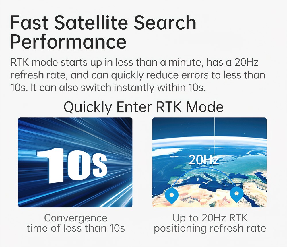
5. Full system multi-frequency RTK engine and starry sky RTK technology
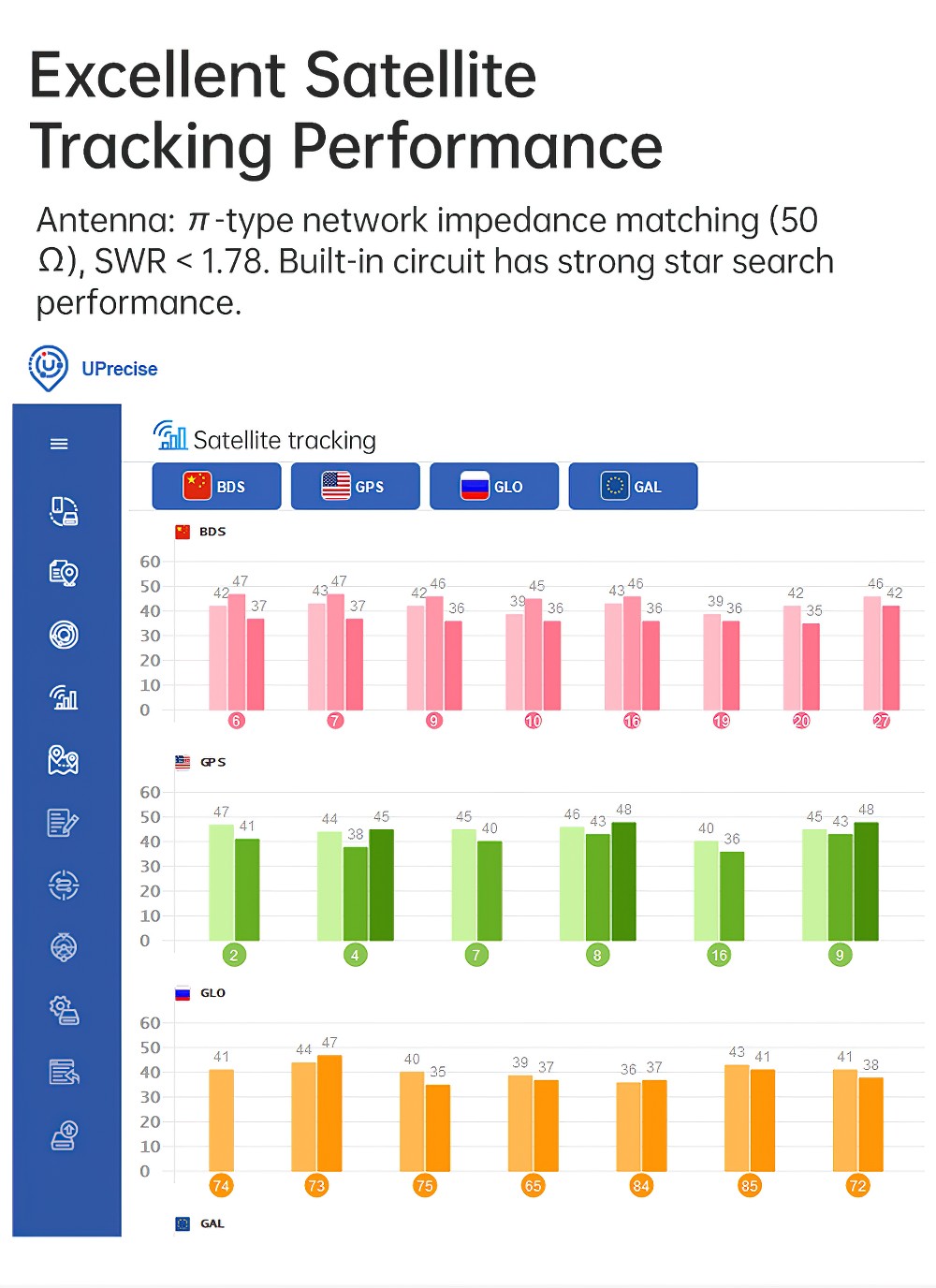
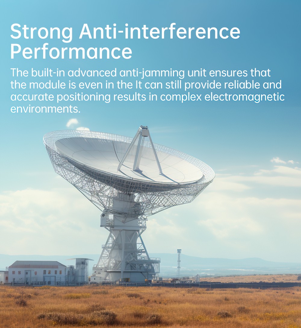
6. Independent tracking of each satellite frequency and 60dB narrowband anti-interference technology
7. Advanced interference detection function
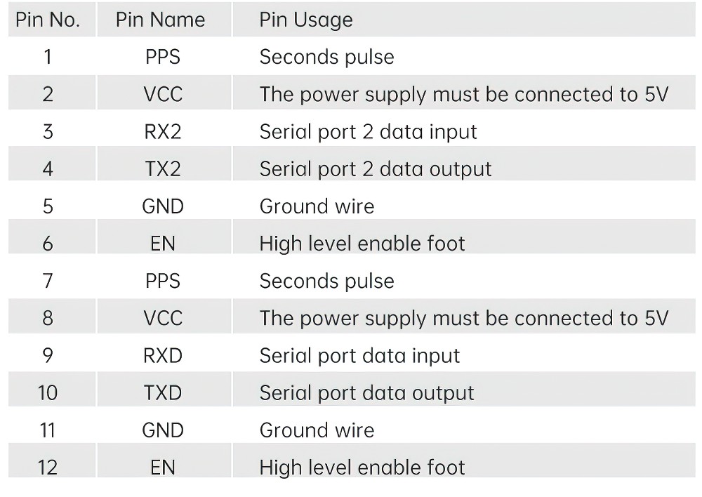
Specifications
Serial number | Parameter Name | Description |
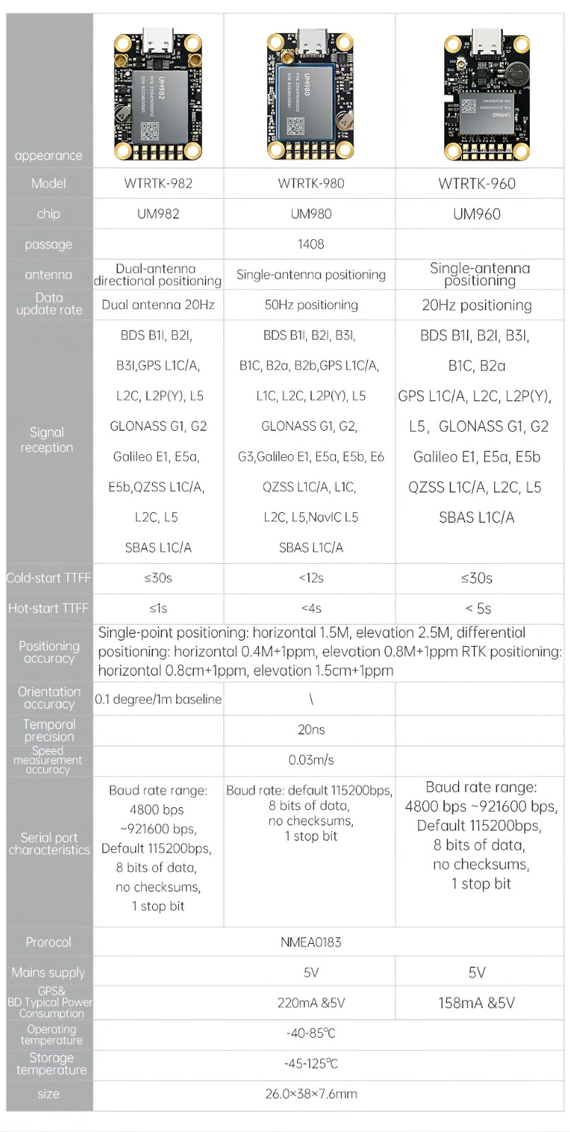
1 | Channel | 1408 channels, based on NebulasIV chip |
2 | Signal | BDS/GPS/GLONASS/Galileo/QZSS |
3 | Frequency | BDS: B1I/B2I/B3I |
GPS: L1C/A, L2P(W), L5 | ||
GLONASS: L1, L2 | ||
Galileo: E1, E5b, E5a | ||
QZSS: L1/L2/L5 | ||
4 | Cold Start TTFF | ≤30s |
5 | Initialization time | < 5 s (typical) |
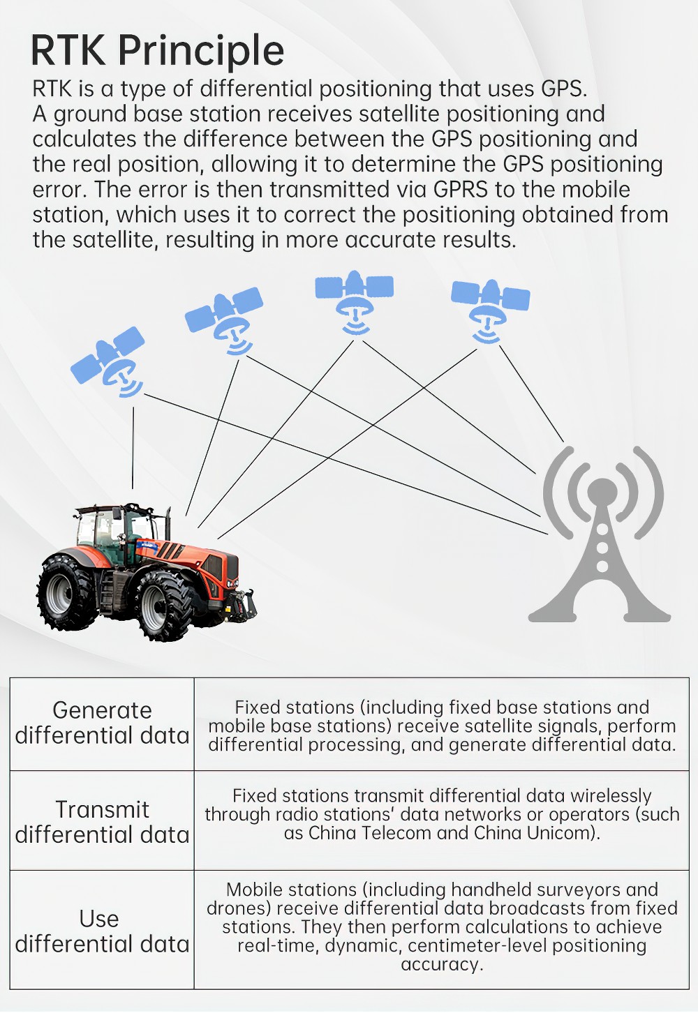
6 | Differential Data | RTCM2.3, RTCM 3.x, CMR |
7 | Positioning accuracy | Single point positioning: horizontal 1.5M, elevation 2.5M; |
DGPS: Horizontal 0.4M, Elevation: 0.8M | ||
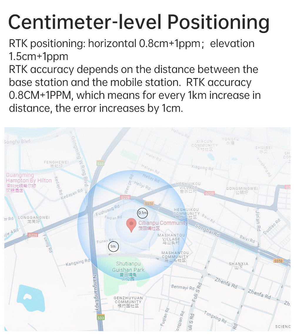
RTK positioning: horizontal 0.8cm+1ppm, elevation 1.5cm+1ppm. | ||
8 | Time to First Fix | Cold start < 30 s |
9 | Time accuracy | 20ns |
10 | Speed measurement accuracy | 0.03m/s |
11 | Data update rate | Positioning and direction finding 20Hz, 20Hz raw observation |
12 | Serial port features | Baud rate range: 4800 bps ~921600 bps, default 115200bps, 8 data bits, no parity, 1 stop bit |
13 | Protocol | NMEA0183 |
14 | Power supply | 5V |
15 | GPS&BD Typical Power Consumption | 158mA &5V |
16 | Operating temperature | -40 to +85 degrees Celsius |
17 | Storage temperature | -45 to +125 degrees Celsius |
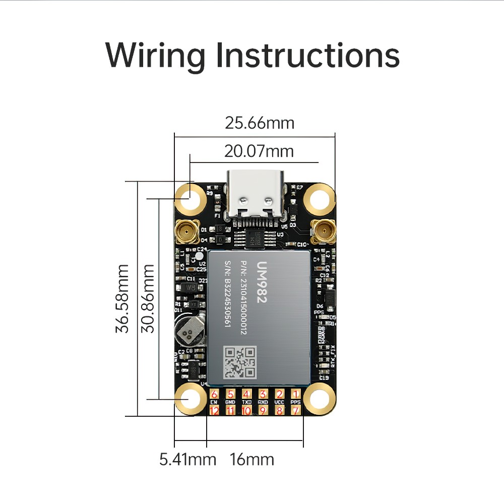
18 | Size | 26.0mm×38mm×7.6mm |
Application

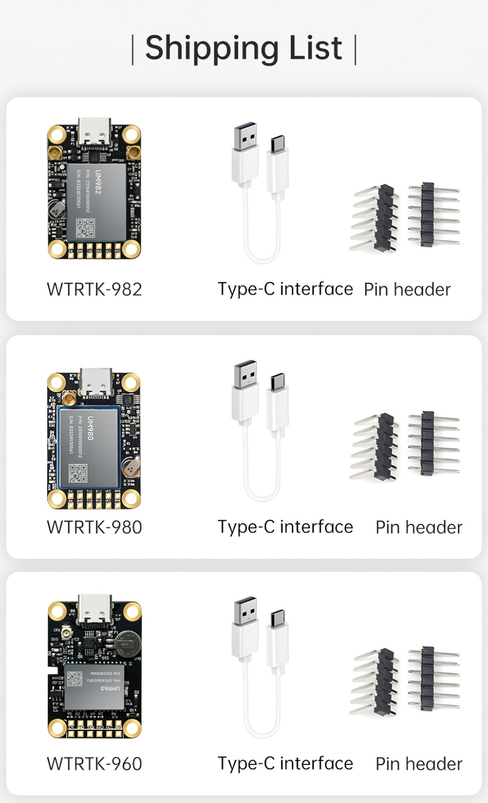
Download
Product InformationVideo